DroneDeploy
Remote inspection tool for advanced multimedia.
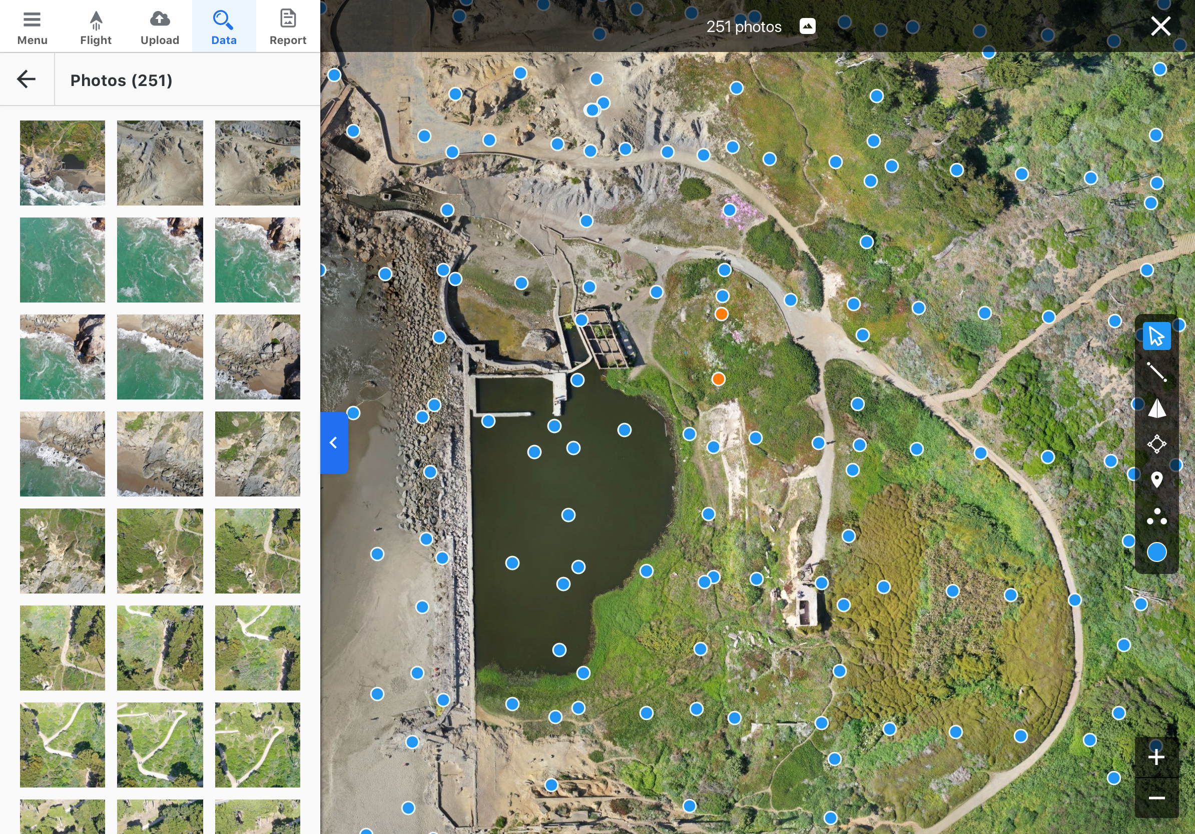
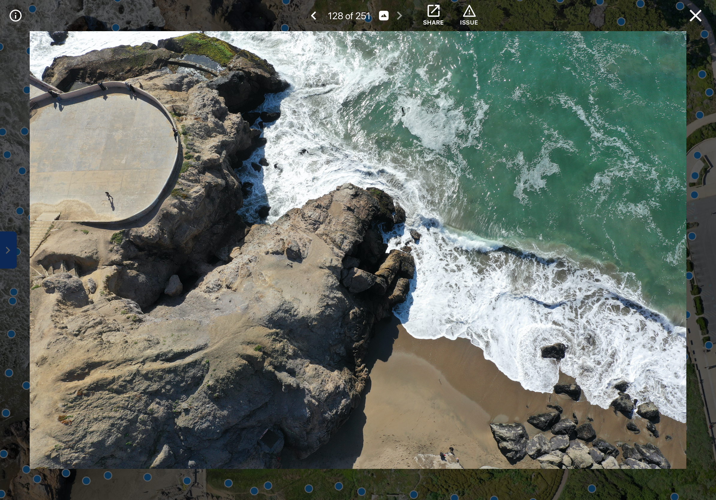
Orthomosaic Inspection
Maps are the core of the DroneDeploy product. Orthomosaics are stitched together through a series of photos taken by the drone in flight.
The resulting map is lower resolution than the source imagery. Customers need a way to view the original images to conduct inspections of the ground surfaces.
By developing a system to see the location of photos on the map and view those photos, we enabled customers to conduct inspection and annotate issues as they review media.


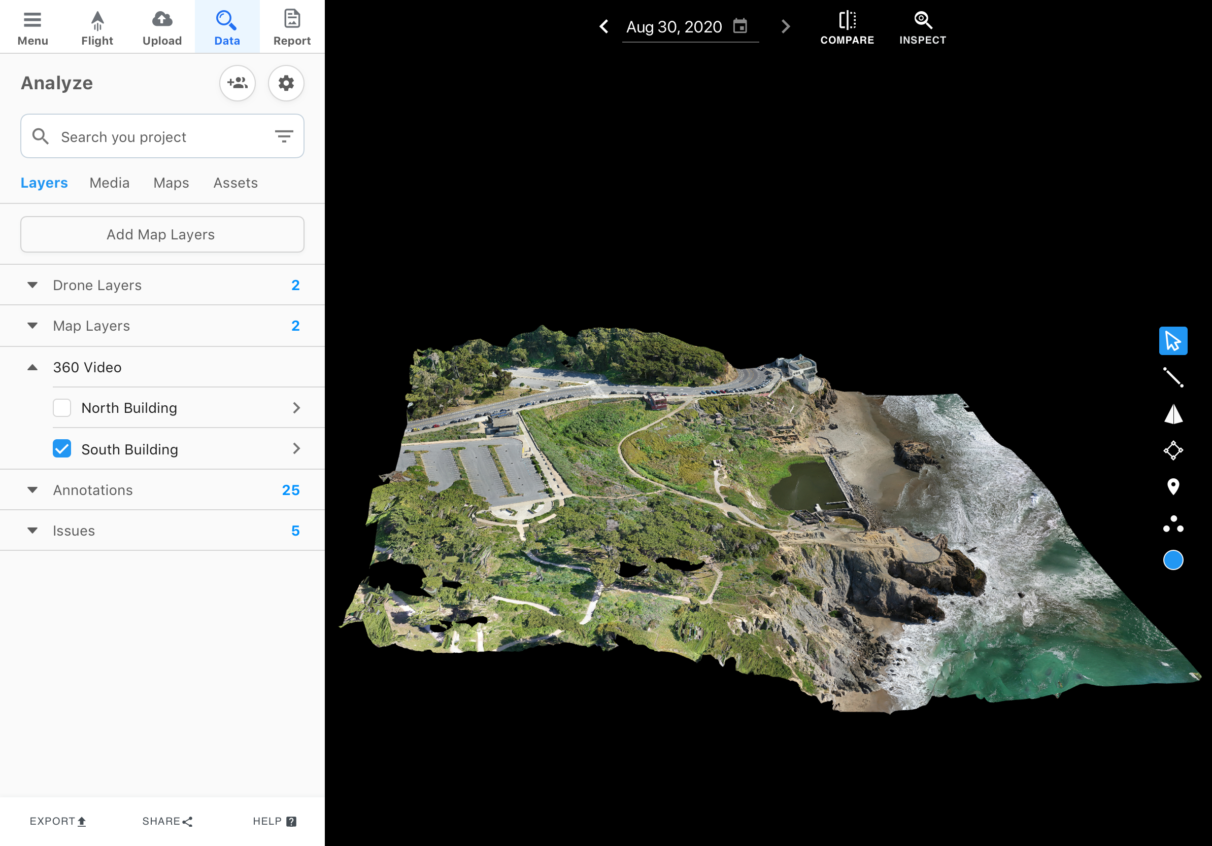
3D Model Inspection
The 3D models DroneDeploy generates through photogrammetry is one of the competitive advantages of the product. The models enable a 360 view of a site.
Many customers use drones to capture content in three dimensions. Using the 3D model allows customers to see full context of where photos were taken.
The photo viewer is built directly into the 3D interface. Designing in navigation like a D-Pad and Nearby Photos we solved many challenges in remote inspection and collaboration.


360 Video Inspection
Drone imagery has limitations. Collecting ground and indoor content accounts for a large opportunity to expand the addressable market.
Designing an interface for 360 Video required a combination of studying similar products like Google Street View, doing usability studies with customers, and working to create consistent and intuitive interactions.
The Walkthroughs product takes 360 videos captured with hand held cameras, converts it to a path that is visible on the map, and is viewable through pano to pano navigation.


Mobile Inspection
Mobile and in field inspections capabilities were core to developing this product. In many cases customers are in remote locations or do not have internet access on site.
The mobile inspection flow followed the same journey as the orthomosaic inspection product. However, the mobile flow needed to be simpler and focused on different visual UI patterns
When designing the mobile flow, although the content and information architecture is largely the same, the UI focuses more on iconography, placement, and consistent dark UI.


Inspection Reports
The ultimate goal for all of these products is to help people communicate relevant information that has been captured. Sharing automated reports is the expected final result for many of our customers.
The reports generated by DroneDeploy need to be customized, presented, and shared in order to effectively communicate the status of a worksite.
The result was an interface that is split between an editable report and a sharable presentation mode.

